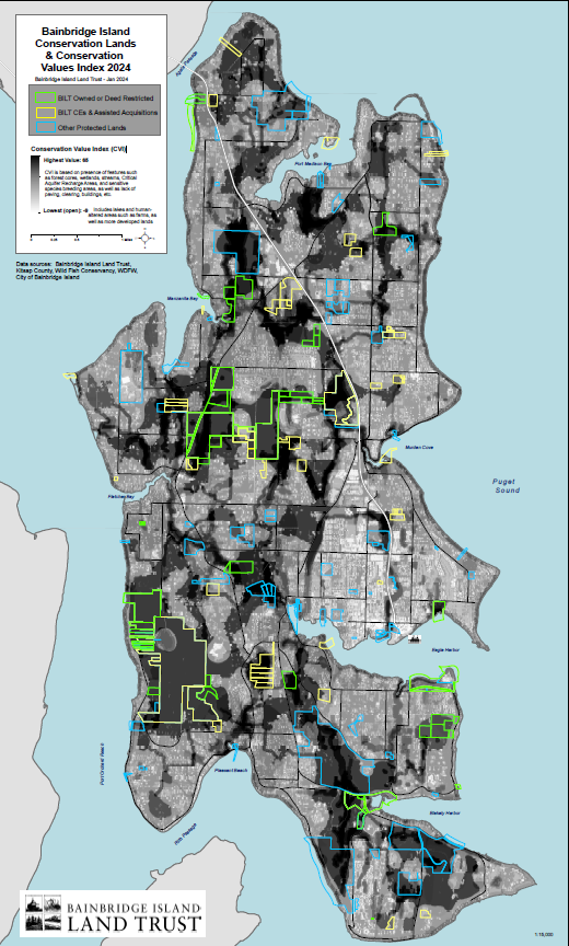
Since 1989, the Bainbridge Island Land Trust has protected some of the most special places on Bainbridge Island, including forests, wetlands, shorelines, streams and riparian networks, agricultural lands, recreational lands and trails, open spaces, and scenic vistas. In 2012, the Land Trust adopted its first ever Strategic Conservation Plan and in 2018 we performed updated analyses of land use trends while also creating a conservation values index (CVI) which highlights those areas with the highest intact habitat and ecosystem attributes worthy of conservation efforts.
Click here to view the CVI map.
To learn more about how the CVI was created, please read the 2018 Strategic Conservation Plan or email Gina King, Conservation Director.
2018 Conservation Plan Update
Appendix A Maps
Appendix D Community Conservation Survey

