Conservation Planning

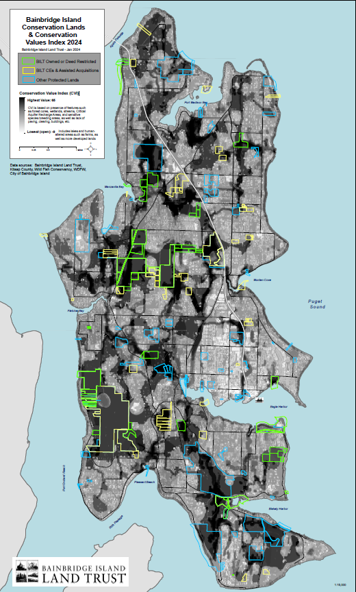
Since 1989, the Bainbridge Island Land Trust has protected some of the most special places on Bainbridge Island, including forests, wetlands, shorelines, streams and riparian networks, agricultural lands, recreational lands and trails, open spaces, and scenic vistas.  In 2012, the Land Trust adopted its first ever Strategic Conservation Plan and in 2018 we performed updated analyses of land use trends while also creating a conservation values index (CVI) which highlights those areas with the highest intact habitat and ecosystem attributes worthy of conservation efforts.

Click here to view the CVI map.

To learn more about how the CVI was created, please read the 2018 Strategic Conservation Plan or email Gina King, Conservation Director.

2018 Conservation Plan Update
Appendix A Maps
Appendix D Community Conservation Survey

The purpose of the Plan is to help guide the Land Trust’s conservation priorities for the next five to ten years and to identify strategies for advancing those priorities. The Plan provides additional direction and guidance for the Land Trust’s board and staff, and community leaders to help ensure that we spend our limited financial and human resources in ways that produce the greatest possible conservation gains for our Island. The Plan has been shared with our community leaders in order to illustrate the Land Trust’s ideas on how conservation objectives can be met as we continue refining our conservation priorities.

If you have any questions regarding the Land Trust’s conservation planning efforts contact Gina King.

2018 Update

The 2018 update to the Strategic Conservation Plan identified the following Trends:

  • The current supply of undeveloped and unprotected land may be gone by 2030, based on a simple linear projection using trends from that past 18-years. This is two years later than the previous projection, based on data through 2010, which was due to the Great Recession’s economic slowdown. About 27% of the island would have some level of protection based on the historic rate of land protection. Please note that land protection efforts over the last 18 years have included many large, one-time efforts, including the private acquisition of the IslandWood campus and an $8 million dollar public open space bond;
  • Very few large, undeveloped and unprotected parcels remain. For example, in 1996 there were 94 undeveloped properties over 10 acres in size. Now, over 20 years later, there are only 35 remaining. It is urgent that these remaining properties are individually evaluated for their value to completing upland wildlife and open space networks on Bainbridge Island;
  • Wildlife preserve size and shape should be analyzed for adequacy to meet the needs of indicator species. Upland wildlife corridors need to be evaluated and likely re-mapped to areas that are already protected or have remaining opportunities for protection. New wildlife networks (including corridors) should be guided by protecting priority habitats and shared with our community, the City and Park District for their consideration during comprehensive plan updates. Consider areas such as the mid-island corridor for additional expansion and look to areas that are not yet connected, such as Gazzam to Islandwood, Restoration Point to Blakely Harbor, etc.
  • More land has been protected by private development through open space tracts in subdivisions and plats than any other private or public conservation effort over the past 18 years. The Land Trust will seriously consider proactive and direct engagement and partnership with the development community – such as our Quitslund project – and work with the City of Bainbridge Island to encourage the alignment of new open space areas with conservation priorities.